Badhaura Fm
Type Locality and Naming
OUTCROP: The type section is exposed half a mile NW of village Badhaura. [Original Publication: Ranga Rao, A., Dhar, C.L., and Obergfell, F.A., 1977: Badhaura formation of Rajasthan - its stratigraphy and age: IV International Gondwana Symposium, 1977, Calcutta, pp.481-490.]
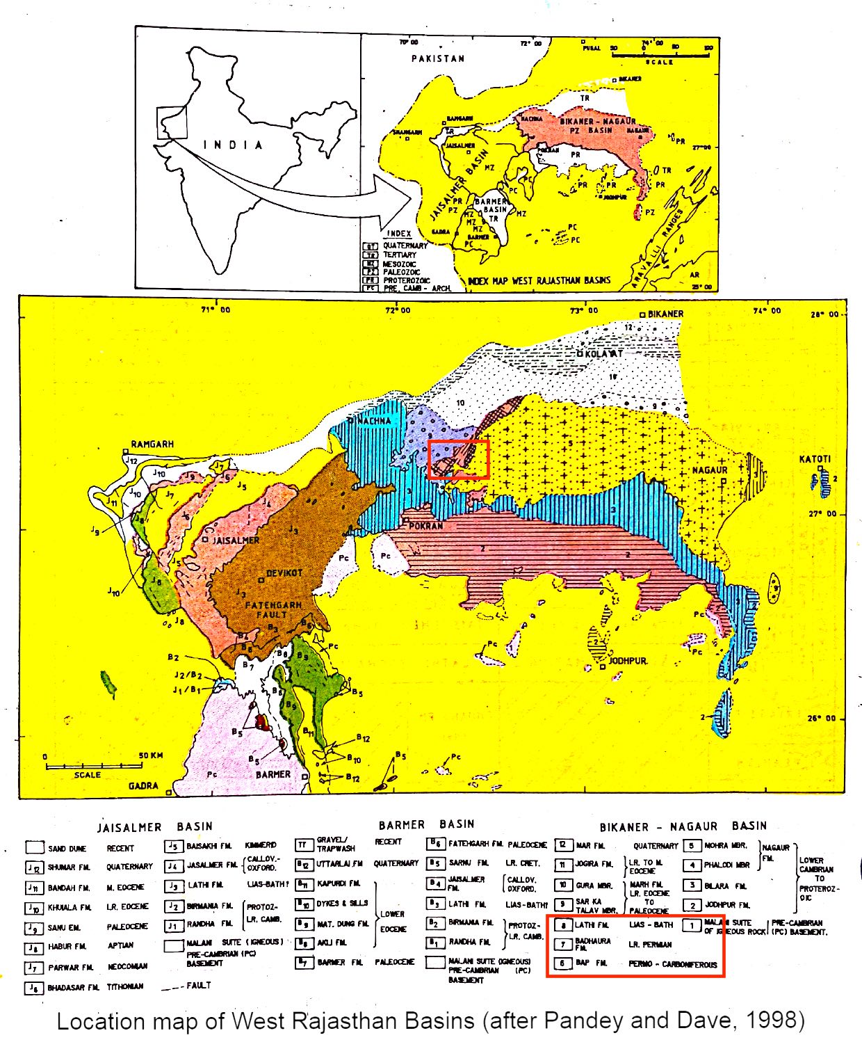
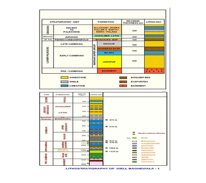
Reference section: Pugal well no:1, interval 500-590 m. Exposures are seen around Badhaura, Bap and south of Kanji Ki Sird, Phalodi, north of Khichand, Malar, north of Bari-Baori.
[Figure 1: Location map of West Rajasthan Basins (after Pandey and Dave, 1998)]
Synonyms: Misra and Srivastava (1960), Ranga Rao, et al., (1977) elaborated Bap Formation along with Badhaura Formation and named this unit as "Bap Boulders and Badhaura Formation". Later on Srivastava and Srinivasan (1962) retained the name and clubbed the Bap Boulder and Badhaura Formation as one formation. According to Khanduri indefinite age (Post Mayakor to Sub Recent) and as such excluded from Badhaura Formation. Ranga Rao et al., (1877) gave a detailed account of Bap Fm and Badhaura Fm, and separated them from each other as distinct formations.
Lithology and Thickness
Coarse-grained sandstone. It consists of yellowish grey to purple, medium- to coarse-grained, gritty, pebbly fossiliferous sandstone with shale. The outcropping surface is blackened by coatings of desert varnish. Its thickness is about 350 m. Its thickness decreases towards NE of Badhaura Village.
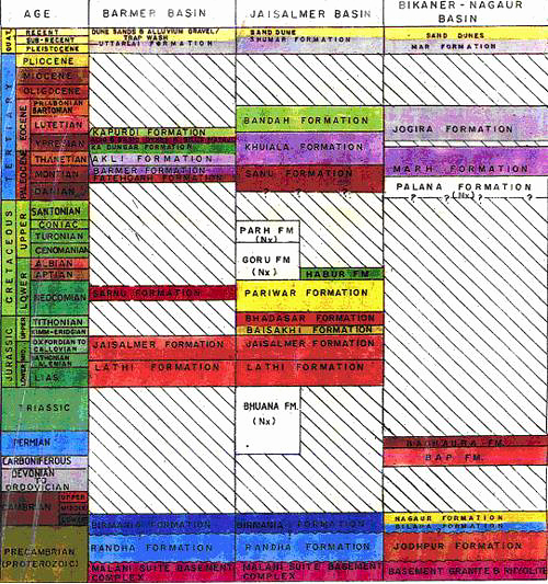
[Figure 2: Generalized and Subsurface Stratigraphy of Bikaner-Nagaur Basin ((from dghindia.gov.in)]
Relationships and Distribution
Lower contact
The lower contact of Badhaura Fm on the underlying Bap Fm is nowhere seen, as it is always covered by sand. However, it is inferred to be gradational.
Upper contact
Major hiatus. It is overlain by Marh Fm in the surface, and by Palana Fm in subsurface with a pronounced hiatus. The upper unconformable contact of Badhaura Fm with Palana Fm is clearly seen in the well Pugal-1.
GeoJSON
Fossils
Ranga Rao et al., 1977 have reported rich assemblage of invertebrate fauna i.e., Paracondularia sp., Lingula sp., Aviculopectan sp., and Crinoid stenos.
Age
Depositional setting
Additional Information


